Ruminations From the Western Slope

Ruminations From the Western Slope
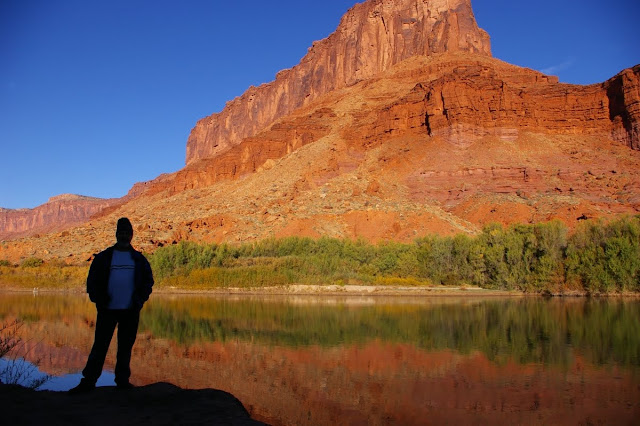
Colorado River near Moab, Utah

Monday, May 25, 2020

Last Time in Little Spring


It was over 45 years ago that I blew into this bizarre and beautiful place to begin one of the most extraordinary periods of my life.  I was young and fearless and full of energy when I started my tenure as a park ranger in the Needles District of Canyonlands National Park.  That was back in October of 1974.  And now I am back again, under a tangle of trees in campsite A7 in Squaw Flat.  Wooden Shoe Butte dominates the eastern landscape spreading its tentacles of sandstone in all directions, into the drainages of Squaw Canyon and Lost Canyon and the very edges of Salt Creek.  The almost holy silence here is broken occasionally by a squawking raven or a desperate visitor looking for a camp site.  I grabbed the very last one this morning at 930am.

And that was after a full bore drive down highway 211, passing cars at every opportunity in hopes of finding a site.  It helps to have driven this road three or four hundred times over the years, knowing every curve and canyon, recognizing individual cottonwood trees and petroglyph panels.  It begins at Church Rock junction with a long open stretch through overgrazed grass and sagebrush, the long climb to abandoned Ogden Center and through Photographers Gap, then down toward the drainage from Harts Draw and the flanks of the Abajo Mountains.   The section down the Dugway is steep and curvy and used to be treacherous in the winter months.  A few errant ponderosas have taken root in the Navajo sandstone.  Just beyond the switchbacks Indian Creek flows in from the south to give the canyon its name and character.

A thick canopy of trees heralds Newspaper Rock and forms an arboreal tunnel for several miles as the canyon walls stay close.  Here and there an etched big horn or shaman figure show themselves on a sandstone wall.  As the canyon widens, the trees stay with the creek while the road meanders along the base of high red cliffs.  The sky opens up, the sandstone pulls away, and the cattle appear around the grasslands near the Dugout Ranch.  The first signs of historic humanity for several miles.  I could finally put the pedal to the metal on the Subaru and make like lightning for the campground where I felt welcome and secure.

Little Spring Canyon welcomed me back again as well after a hiatus of many years.  My secret place, private getaway, and pleasuring ground is harder for a 69 year old man to get into than a 29 year old but I managed.  I kept thinking that this would probably be my last shot at it so I was determined to make it at least as far as the first set of springs under the cottonwood gallery downstream.  Having a walking stick really helped but I still stumbled and bumbled my way over the hard gray limestone and the crumbling weathered sandstone shelves.  I bouldered down a small pour off and squeezed through a rocky tunnel before reaching the edges of the canyon where I descended on an old deer trail to the sandy floor.

The memories came flooding back even before I had reached level ground.  I recognized an old juniper snag, little changed in four decades.  I remembered the first time Susan and I discovered this place, in the dead of winter no less. Frozen formations of ice along the banks portended bubbling pools in the spring.  And so it was.  By mid May there was lots of cold, fresh water seeping to the surface at the cottonwood gallery, then trickling on down the canyon in a series of pools, cascades and freshets.  Places to soak a naked body.  Places to make love in utter privacy and openness.

There was the time that Phil and I ingested some mescaline and spent a very long day hiking downstream as far as we could, to the imposing confluence of Big Spring Canyon and then to the even more imposing confluence  of Salt Creek.  We traversed ledges full of fossil crinoids and brachiopods.  We walked through dark polished halls of limestone.  We thought we could walk all the way to the Colorado River but we eventually got rimmed out.  And then we hiked all the way back to the front country.  All in one unbelievable day.

There was the time Cindy and I got caught in a savage rainstorm near the confluence of Big and Little Spring and hiked like hell to find shelter high above the creek.  I was expecting a flash flood that never came, but we spent a primal night in a large alcove above the springs, firelight flickering off of walls like a Pleistocene parlor.

One summer Mary Ann and I discovered a cache of ancient puebloan artifacts near the first spring.  There were several arrowheads, part of a woven yucca sandal, a ringlet of pressed desiccated flowers, an arrow shaft.  We stashed it all back where it came from.  I looked for it today but there are only a few flaked lithics left at the site.  For years we swore ourselves to secrecy that we would never mention the name of the place.  But people are still getting down there even though the canyon is not marked nor advertised. 

Yet today it did, indeed, seem to welcome me back.  The springs are not as vigorous as they used to be.  Clean, fresh water no longer bubbles out of the ground.  Instead there is a much smaller seep that feeds the creek with a shallow, algae lined run.  Maybe the water table has dropped.  Maybe too much water has been diverted over the years to keep the thirsty campers happy.  Maybe as with me, age has taken a certain toll. In any case, the big cottonwoods still hold sway.  They were all shades of gold and yellow today and huddled together thickly downstream, a riparian fortress I could not break through.


But none of that truly mattered.  I had made it back.  And I made it back out as well.  And I am grateful to be among a probable handful of people who have really experienced this place...and maybe it has become a secret place for them as well.  If there ever was an Eden it must have been very much like this hidden garden in the midst of a wilderness of stone.  I grow older and less able but the canyon remains and I know it is still there and still vital, and that's good enough for me.

The Art of Campfire


I have become quite adept over the years at making good campfires.  I am not talking about the big, blazing “white man” fires one often sees in campgrounds, but the quiet little fire that flares and flits around two, maybe three logs....large enough to warm the hands but not so large as to drive one away with smoke and heat.  I have started fires under some of the most extreme conditions in past times.  There was the little fire I got going when Phil and I holed up in a cave at Canyonlands during a snow flurry.  No paper and not much wood.  Just a bit of juniper bark and some twigs, but that was enough.  Then there was the time in Little Spring Canyon when Cindy and I got caught in a major rain storm and had visions of being flash-flooded down into the Colorado River.  But I led us to a large alcove that I had remembered and we found enough downed wood to get a fire going and make a sweet little campsite.  And the canyon never did flood.

So I’ve got one such fire going right now in the metal fire ring at the Pinnacles camp site I am currently occupying.  The sun finally shone brightly today as I drove north from Paso Robles, stopping in King City long enough to pick up a few supplies.  After that it was back to that oh-so-familiar road that climbs gently into the Gabilan Range, winding first through fertile farms on the edge of the Salinas Valley, then climbing up into hills thickly clad in chaparral and open pastures dotted with oaks, gray pines, and cattle.  I have a familiarity with this area going back more than fifty years now, and I lived in these mountains for four of those years as a park ranger.  When I stepped out of the van at one point to snap a photo or two, the air was redolent of memories and an internal kinship that is hard to explain.

In spite of the Sunday crowds trying to get into the park today, I found my campsite and unloaded as much stuff as I could.  And then I took a solitary hike along the south fork of Chalone Creek, through dazzling green grass and immense valley oaks all twisted and gnarled and leaning over like old men.  Quail darted out of the underbrush, and I scared up some rabbits.  Dotting the sparse ground cover here and there were bright orange poppies and johnny jump ups.  And to my left, the braided, shallow stream of the Chalone.  It was a perfect way to ease back into the Pinnacles experience.

It is wonderful to see the familiar brilliant hues that bedeck this landscape.  Luminescent green moss.  Pink rhyolite with bright orange lichens.  No wonder this was the spot where, as young friends we dropped acid, took psilocybin and smoked lots of dope back in the day.  Those highs have lasted me for decades.  Later when I trekked through the Bear Gulch Caves, I had more energy than I have felt in a long time.  The caves were full of deafening cascades and running water underfoot.  It was a real challenge getting through them for this old man.  But the pay off was being able to stroll back down along the Moses Spring Trail past bunches of shooting stars, and damp hollows filled with chain ferns.  All in all, I put in over four miles of walking.

So now my fire is nothing but glowing embers and, if I have done if all right, there will be nothing but a pile of gray ashes by morning.

Tuesday, August 27, 2019

Gazos Creek

By the time Gazos Creek meets the sea its shallow and serene waters have left behind their point of origin where fingers of distilled fog have coalesced under dark redwood duff, coursing downward through forests of fern, laurel and tan oak, with enough vigor to push their way under Coastal Highway One through deep sand.  Quite often the water never reaches the Pacific leaving only a damp stain just yards from its intended destination.  But today the stream is flowing vigorously, coming in clean and clear across the broad beach, taking a sharp turn to the north before curving again just as sharply to the south in a fluid oxbow before making one last arc into the briny tide.

This is our rock of ages, the place we have returned to again and again for over sixty years.  In our lifetime the soft cliffs have eroded back several feet.  Sea stacks have dissolved into piles of rubble.  And the fields of brussell sprouts and artichokes above have now reverted to thickets of wild radish and mustard, protected by the state of California.  And the four of us have gone from crazed adolescents into senior gentlemen who hit the old trail with walking sticks, eyeglasses, prescription drugs and a slightly more measured gait.  There is no hurry.  Plenty of time for plenty of stops, and the sound of familiar voices lilting in the wind.

  The tide is ebbing, revealing the rocky underpinnings of this coastal strand.  A few harbor seals bask on exposed outcrops, unphased by our presence.  A line of pelicans skims along the strand.  At the end of the beach we scatter.  Steve squats down to study a tidepool.  Stan salvages some old fishing line and a hook from the base of the cliffs.  Dave steps carefully over kelp-covered stones to get a closer look at a seal.  And I head around the point to find the Cave. 

The Cave has been a destination for us since Stan and I first came upon it back in 1962.  A natural tunnel punched through a narrow point by the incessant surf, accessible only at low tide, a one-time treasure trove of tidal life...starfish, nudibranchs, crabs, eels and even an occasional small octopus.  I scale the last obstacle of slippery rocks and scramble down to the west-facing entrance.  The tide is not quite low enough to enter but I can see the iridescent purple walls, the lime-encrusted ceiling, the shimmering pools within.  But mostly I am struck by the paucity of tidal life these days.  No big gumboot chitons or darting sculpins.  Not a single starfish.  Just a smattering of turban snails, a few small sea anemones, and a scrambling shore crab or two. 

The Cave still stands firmly against the surf but its interior has succumbed to the vicissitudes of time, to fifty years of changing climate, indiscriminate collecting and the transition of our oceans from a mysterious world of wondrous creatures to a convenient vast garbage dump.  That is the discouraging part of it.  But I get some measure of satisfaction at still being able to revisit this secret place so much a part of my childhood memory and makeup.  The stuff that fantasy and adventure are made of.

 And the one thing that has not changed over the years is the bond of friendship with these other gentlemen who share the shoreline with me today  As we gather up our walking sticks, our packs and a few mementoes of shell and driftwood, we reverse course and slowly saunter back toward our cars.  Back along the fractured cliffs.  Back into time.  Spinning out the stories of our long, individual journeys.  And I take it all in and embrace every minute of this time together because, in the back of my mind, always bubbling up  like a tidal swell, is the thought that this could be the last time for us.  The could be the last communal journey along Gazos Creek and this amazing edge of the continent.


Wednesday, April 10, 2019

The Last Road Trip - Conclusion

Wednesday, March 27      Kanab, Utah

Today has been a long but exhilarating day, taking in four states in 400 miles and 10 hours of driving, more or less.  I left Barstow, California this morning at 6am while darkness still lingered over the Mojave.  I got on that seemingly interminable stretch of interstate heading for Las Vegas.  The oncoming dawn softened things quite a bit, imparting an eerie hazy glow to the distant mountains and the gray stretches of creosote bush and dry lakebeds.  By 9am I was in Henderson where I stopped at a Trader Joe’s to do some shopping.  I had already made the decision to drive straight through to Kanab, Utah rather than doing another night of camping at Lake Mead.  I just wanted to get closer to home and the sooner the better.

As soon as I got on the road again, I headed out of the Vegas megalopolis and into the stark hills surrounding Lake Mead.  Once again I drove the North Shore Drive that winds through folded, upthrust mountain ranges, dark volcanic ridges, and burnt red sandstone outcrops...all this punctuated by massive blooms of brittle bush and desert sunflower.  I stopped at a roadside picnic area to have a short brunch of yogurt, banana and cheese.  Then back in the van driving north through the Mormon towns of Overton and Logandale, and finally connecting back on to the Interstate at Moapa.  I was making good time in my own leisurely way, nearly out of Nevada and ready to cut through that small but intense slice of Arizona where the interstate makes a spectacular climb up and through the Virgin River Gorge.  This is the gateway to the Colorado Plateau.  This is the familiar way back.

Just past the Arizona/Utah border I got my first glimpse of the snow-clad Pine Valley Mountains and the beginnings of the urban sprawl that is now the greater Saint George metropolitan area.  Massive stretches of desert are being scraped away to make room for more tract homes, golf courses, RV parks.  The traffic becomes intense.  And I keep thinking where will all these people get their water from.  Both the Virgin River and the Colorado are nearly tapped out, yet the building continues unabated with unreasoning faith in the Almighty that all needs will be met.  When, in fact, it is a recipe for disaster.

Nevertheless, I pushed on through as quickly as possible with one quick stop in Hurricane for fuel.  I was determined to drive through Zion National Park even though I knew there would be hordes of tourists there and possibly some traffic jams.  Yet I couldn’t help but feel that old magic as I made my way through Rockville and into Springdale.  I was remembering my first view of Zion way back in 1967 on a college geology field trip.  52 years ago when this was a narrow two-lane road and Springdale was just a tiny portal town on the edge of the park.  It was spring equinox then, and in the upper reaches of the canyon where our group all camped for the night, I got high on weed for the first time with a biker dude named Duncan.  I can still picture that shimmering moon shining above the Great White Throne.

When I entered the park proper, there were even more automobiles  than I had initially expected.  I realized that it is Spring Break time right now for many schools, and the park was over run with people.  Every turn out was filled to capacity with vehicles.  But I was not intending to stop in the valley anyway so I pressed on, over the Virgin River Bridge and up the steep switchbacks that lead to Zion’s east rim.  It was slow going due to recent road damage, but slow is good in this neck of the woods.  Plenty of time to take in the massive walls of Navajo sandstone.  Beyond the tunnel, the rim country opens up in crossbedded palisades and sculpted cliffs.  Rock resembling pulled taffy.  And even though nearly every pullout held its quota of cars, I managed to find one unoccupied one where I stopped the van and decided to take a short hike.

I grabbed my cameras and made the easy descent down to the edge of Clear Creek where the cold water flowed gray green through stands of bare oak trees, yuccas and a few ponderosa pines.  And no people.  Above me the cars continued to wind by but, for the moment anyway, I had the creek bottom all to myself.  I skirted the shoreline, photographing patterns in the rock and listening to the sweet sound of desert water.  I walked until I reached a “narrows” where the shoreline ended and the creek was constricted between sinuous walls and the water flowed bank to bank.  By this time, a few other humans were filtering into my space so I made my way back to the van, feeling satisfied that I had grabbed at least a modicum of isolation and serenity.

As I continued out the east entrance road, I was feeling grateful for all the times I have spent in this place before it became overrun with humanity.  I especially remember the early 90s when Amy and I would come here every fall, camping in the valley but coming up to the east rim to play and get away.  Where we could capture the first light of day with our cameras.  Where we could take off all our clothes and make love on the smooth stone.  Where we could enjoy the primal experience in the illusion of being the only people on earth for that moment.  And in my old age I can still feel that rush of passion and primitive sunlight, but we are no longer the youngsters who could easily escape into a secret canyon.  And the secret canyons are no longer secret.

Still, it is hard to not be impressed by the overwhelming ocean of sandstone through which the road passes.  And near Checkerboard Mesa, I was duly rewarded with sight of a small group of bighorn sheep not far off the road.  There were several females and three newborns, perhaps only two or three weeks old.  And one young ram nearby surveying his domain.  A number of tourists had pulled over to take pictures and I did the same, but the sheep seemed nonplussed by it all.  And in so doing gave all of us the momentary gift of excitement and awe, and a little peek into a fading mountain west.

Upon leaving Zion, the roadside opens up in broad vistas of mountain and mesa.  Forests of pinyon and juniper.  I could see patches of snow against the pastel pinks of the Elkheart Cliffs as I dropped down to the junction of Highway 89 at Mt. Carmel Junction.  There I decided to head north a few miles to a favorite old book store in Orderville, owned and operated by a character named Lance who usually has a few old pulp paperbacks I can get interested in.  This time around he did not have much to offer except his opinions on immigration, homeless people, and how the Trump administration is an improvement over what we had before.  He was really giving me more information than I wanted to hear.  I bought a few books anyway and told him I’d still be a customer in spite of his backward politics.  We shook hands amiably and I headed back south to Kanab where my friend Mike and I could discuss the weird ways of the world, down a couple of gin and tonics, and watch another great old movie.  This time it was, appropriately, In a Lonely Place with Humphrey Bogart.

I have covered a lot of ground in two weeks. Driving these long, familiar stretches my head fairly explodes with thoughts, musings and many memories.  This country is ingrained in the fiber of my being.  Over half a century of camping, hiking, driving, exploring, working, romancing.  I feel enfolded in the rock, imbedded in the sage, and empowered by the open space.  And I can look back on incredible diversity of experience from the seedy edges of Barstow to the old California mission at San Miguel.  Shorebirds on the mudflats of Morro Bay and shooting stars in bloom on the hills of the Pinnacles.  Bookstores in Cambria and rain clouds rising above the Carrizo Plain.

I return to Grand Junction renewed and ready for what the future may bring.

The Last Road Trip - Part 6


Tuesday, March 26         Barstow, California

Yesterday I awoke to clear skies and cool temperatures, got some coffee going and, after a bit of warm up, got myself on the trail again.  I decided to walk to the Balconies and back, a round trip of about five mostly level miles.  I have so much history and so much familiarity with this place that just about anywhere in the park, I feel comfortable and welcome.  I parked at the trailhead, grabbed my cameras and trusty walking stick, and began walking the trail that was once the road to “Old Pinnacles”.  I remembered a time back in 1964 when Stan and I drove this road on January 1 and camped at the base of the Balconies.  It was bitter cold and no one else was crazy enough to be camping there.  We spent the night sleeping in his parents’ old Ford.

The trail as it is now pretty much follows the south fork of Chalone Creek which is currently flowing with fresh, clear water.  I took my time ambling along, stopping to photograph wildflowers as I came upon them….shooting stars, a chaparral nightshade, milkmaids.  I passed the former site of the Chalone Creek Campground, closed many years ago and now just a part of the natural creekbed.  This is the spot where I took LSD for the very first time back in December of 1967.  Why we persisted in visiting the park in the dead of winter, I will never know.  But I do recall that, with rain imminent that day, we (Jim, Stan, Steve and I) all high tailed it over to Santa Cruz taking refuge in a friend’s crash pad.  There, as I came down from my acid trip, we listened to Jefferson Airplane’s latest LP, After Bathing At Baxters, and the music absolutely transported me to another place.  Still one of my favorite records to this day.

In any case, the walk was near perfect as the trail crossed the shallow creek several times, wove through little forested groves of buckeye and blue oak, and across sunny stretches of chaparral.  Eventually I caught sight of the huge massif called the Balconies, an enormous chunk of rhyolitic stone rising above the canyon.  The Balconies Caves were closed due to high water but I walked as far as I could to where an iron gate blocked my path.  Beyond the gate I could hear the roar of falling water coming out of the dappled darkness.  A few minutes later, as I started back, I found an old log to sit on where I could snack on an apple and some dried venison.  Above me loomed the towering Machete Ridge, another major landmark of the area.  One could call it the El Capitan of Pinnacles.

The return trip seemed to go quickly and I was back at the campground by 2pm.  I spent the rest of the afternoon reading and relaxing in the sun, watching turkey vultures soar on afternoon updrafts and California quail scurrying from one bush to the next.  When I woke up this morning the sky was overcast and threatening rain.  So I packed up hastily and began what was basically my return trip home.  The highway beyond the park wound through velvety green hills of the Gabilan Range, then turned east over the more rugged southern Diablos toward Coalinga.  After that it was the long and boring drive south on Interstate 5 through the arid and empty landscape of the western San Joaquin Valley.  Then up and over the Tehachapis at Arvin before dropping into the true desert at Mojave.  Exactly 300 miles from my campsite at Pinnacles to the Hotel 6 in downtown Barstow.  The beginning of the end.

The Last Road Trip - Part 5

Sunday, March 24        Pinnacles National Park, California

I have become quite adept over the years at making good campfires.  I am not talking about the big, blazing “white man” fires one often sees in campgrounds, but the quiet little fire that flares and flits around two, maybe three logs....large enough to warm the hands but not so large as to drive one away with smoke and heat.  I have started fires under some of the most extreme conditions in past times.  There was the little fire I got going when Phil and I holed up in a cave at Canyonlands during a snow flurry.  No paper and not much wood.  Just a bit of juniper bark and some twigs, but that was enough.  Then there was the time in Little Spring Canyon when Cindy and I got caught in a major rain storm and had visions of being flash-flooded down into the Colorado River.  But I led us to a large alcove that I had remembered and we found enough downed wood to get a fire going and make a sweet little campsite.  And the canyon never did flood.

So I’ve got one such fire going right now in the metal fire ring at the Pinnacles camp site I am currently occupying.  The sun finally shone brightly today as I drove north from Paso Robles, stopping in King City long enough to pick up a few supplies.  After that it was back to that oh-so-familiar road that climbs gently into the Gabilan Range, winding first through fertile farms on the edge of the Salinas Valley, then climbing up into hills thickly clad in chaparral and open pastures dotted with oaks, gray pines, and cattle.  I have a familiarity with this area going back more than fifty years now, and I lived in these mountains for four of those years as a park ranger.  When I stepped out of the van at one point to snap a photo or two, the air was redolent of memories and an internal kinship that is hard to explain.

In spite of the Sunday crowds trying to get into the park today, I found my campsite and unloaded as much stuff as I could.  And then I took a solitary hike along the south fork of Chalone Creek, through dazzling green grass and immense valley oaks all twisted and gnarled and leaning over like old men.  Quail darted out of the underbrush, and I scared up some rabbits.  Dotting the sparse ground cover here and there were bright orange poppies and johnny jump ups.  And to my left, the braided, shallow stream of the Chalone.  It was a perfect way to ease back into the Pinnacles experience.

It is wonderful to see the familiar brilliant hues that bedeck this landscape.  Luminescent green moss.  Pink rhyolite with bright orange lichens.  No wonder this was the spot where, as young friends we dropped acid, took psilocybin and smoked lots of dope back in the day.  Those highs have lasted me for decades.  Later when I trekked through the Bear Gulch Caves, I had more energy than I have felt in a long time.  The caves were full of deafening cascades and running water underfoot.  It was a real challenge getting through them for this old man.  But the pay off was being able to stroll back down along the Moses Spring Trail past bunches of shooting stars, and damp hollows filled with chain ferns.  All in all, I put in over four miles of walking.


So now my fire is nothing but glowing embers and, if I have done if all right, there will be nothing but a pile of gray ashes by morning.


The Last Road Trip - Part 4

Thursday, March 21   San Luis Obispo, California

The full moon rose at the Carrizo Plain but I never saw it.  Too many storm clouds gathering and rain shortly thereafter.  The winds rocked the van as I tried to sleep.  Nevertheless, yesterday morning dawned relatively clear and dry.  But I knew more rain was imminent so made the decision to head for indoor accommodations.  That being said, I took my sweet time packing up.  I took a short walk near the campground, winding through open tracts of low grasses and chaparral.  There were the usual abundance of goldfields and fiddlenecks, but also some nice poppy stands.   Here and there a jackrabbit would dart from the brush.

Once I left the campground, I headed north through intermittent rain, stopping when I could to photograph the dramatic landscape.  This included a hillside full of blooming baby blue eyes near Soda Lake, the most I have ever seen in one place.  When I reached Highway 58, I elected to drive east for several miles to catch the colors in the Temblor Range.  I was not disappointed.  The hills were luminescent with yellows and oranges.  I spent a good deal of time taking pictures before turning around and heading west on 58 toward Santa Margarita and the coast.  Classic California inner coastal terrain along the way.  Big valley oaks and gray pines.  Splotches of wildflowers everywhere.  I played Dark Star by the Grateful Dead as I wound around the green hills and valleys.

In the end, I decided to head to San Luis Obispo as I had not been in that town for over 40 years.  Found a decent motel and took a drive out to Morro Bay where I could see the Pacific Coast once again.  Since then I have been catching up on mail and on writing.  This morning I plan on checking out the nearby Spanish Mission.

My health seems to be holding.  Although I look at the end of my arms and see an old man’s hands.  And I am surprised at the loose skin and liver spots. I am surprised that I am nearly 72 years old.  And the thoughts make me feel more vulnerable than I have ever felt before.  This while my 93 year old mother has just been admitted to a 24-hour care facility, and my daughter Alison is going into induced labor tomorrow in Reno.  It is a lot on my plate.

Yet I look forward to the last big destination on this journey.  My stay at Pinnacles National Park. Then the long and daunting drive homeward.