Ruminations From the Western Slope

Ruminations From the Western Slope
Colorado River near Moab, Utah

Wednesday, April 21, 2010

A HORSE OF A DIFFERENT COLOR


Up to now I have largely steered clear of controversy on this blog, but at the risk of looking like a bad ass, I feel that I need to address the divisive issue of so-called “wild horses and burros”. If wild horses looked like cows or sheep, there never would have been a Wild Horse and Burro Act passed by Congress. They graze like cows and sheep. They tear up the landscape like cows and sheep. But unfortunately for the untamed lands of the west, horses and burros fall into the classification of “charismatic megafauna”....cute, furry animals that are just too adorable not to protect. For public land administrators, these hoofed critters present a real management challenge, while to animal rights advocates they have become icons of the historic frontier.

So let’s set a few things straight from the get go. Wild horses and burros are not native. They are descendants of animals that either escaped captivity or were set free by their original owners for one reason or another. When Lewis and Clark traversed the continent in 1803, there were no herds of majestic horses running fast and free. There were no fuzzy burros roaming the desert southwest either. But there were vast herds of bison, antelope and elk who inherited their environment legitimately through natural evolutionary processes. Yet the wild horse has somehow come to represent the pre-Colombian ideal of an undiscovered land.

As an ex-land manager myself, I can honestly attest to the folly of trying to maintain a non-native animal population in a place they never should have been in the first place. Much of Red Rock Canyon National Conservation Area is also a Wild Horse and Burro Management Area as set aside by the Wild Horse and Burro Act. This act is a mandate, passed by Congress, to protect these creatures by any means possible. As a result, over the last thirty years, populations of horses and burros throughout the west have exploded.

At Red Rock Canyon, the scarce perennial springs were trampled and soiled by these interlopers, leaving the native big horns to fend for themselves elsewhere. For the horses, it was a marginal existence at best and I can well remember what it cost the BLM in one instance to haul water out in the middle of nowhere to sustain six scraggly mustangs. These nags had no business being where they were but because they were there, we had to provide for them. The burros were a slightly different story. Native to the Siberian steppes and well adapted to extreme habitats, they bred like rabbits and could forage and survive just about anywhere.

So what about the BLM’s adoption program, you might ask? I can only say this. Just about anyone who has ever wanted to adopt a horse or burro has done so already. There are more animals than there are willing adopters. Currently BLM has over 34,000 horses and burros in captivity which they must feed and maintain at an annual cost to taxpayers of over $29 million dollars a year! And this figure doesn’t take into account the cost of endless round-ups, water hauls, and "range improvements."

Now, I am not insensitive to horses and burros per se. I don’t have an axe to grind here. I am just calling for some sensible solutions to an undeniable problem. Mass sterilization might work though it could be rather costly and logistically difficult. Removal by shooting or trapping is another option. This is the one that raises the hackles of the animal rights folks. But think about it. These are feral animals.....like cows, sheep and pigs. They just happen to look prettier. The faster we restore some balance to public lands, the better for all of us, the better for the native animals, and the better for the horses and burros who can live a happier, healthier life.
Monday, April 5, 2010

INTO THE MILD - Conclusion


March 21 - I have never regretted being an early riser. There is something almost holy about going out into a world still mostly asleep and catching the first deep lavender makings of dawn on the eastern horizon. There is an optimism about starting a new day. And there is opportunity for us shutterbugs who need to catch that first, golden light.

And so it was with me. I was packed and out of the campground before sun up. As I proceeded south along the eastern edge of Death Valley, I watched that first light hit the top of the Panamint Range, highlighting the snowcapped Telescope Peak (at 11,000’+ the highest point in Death Valley). I had sixteen miles between me and Badwater so I took it slow and easy on the curvy two-lane road. Along the way, I saw my first Death Valley wildflowers, a large array of brown-eyed evening primrose. When I finally pulled into an empty Badwater parking area, I was the only human anywhere in sight. and the lighting was just about as perfect as I could wish for.

There were only two minor logistical problems. Due to resource damage from the hordes of people who now regularly descend upon the salt flats here, the National Park Service built a raised boardwalk several years ago which allows for a decent view of the lowest point in the United States but intrudes itself into the reflecting salt pools. Furthermore, there are several emphatic signs admonishing visitors to not get off of said boardwalk. This makes capturing the classic morning view of the pools well nigh impossible anymore. With a bit more thought, the boardwalk could have been more optimally placed but such is sadly not the case.

Well, I am an early riser. And there clearly was not another human being within several miles. So I gingerly stepped off the boardwalk and trod as lightly as I could to a point where I could capture that fabled reflection of the Panamints in the salt pool. By squatting at just the right spot, I was able to lose the boardwalk off the left hand frame and get a close approximation of the picture I had wanted so badly....not perfect by any means but still pretty impressive. I have to point out that I was not being cavalier about this because I am an ex-ranger and feel somehow privileged to break park rules. But sometimes regulations need to bent just a little bit if one knows that no real damage is being done.

I rattled off several frames before returning to my car and continuing the long, leisurely drive toward Jubilee Pass. Along the way I was treated to more patches of primrose, and great sweeping vistas of salt flats, standing water reflections, fat green creosote bushes, and broad alluvial fans swooping down from the Panamints. I gloried in the quintessence of Mojave desert as I climbed over Jubilee Pass toward Shoshone. I was so energized that I ended up driving all the way to Kanab, Utah that night and all the way home to Grand Junction, Colorado the following day.

Behind me I had put the haunting hoodoos of the Paria Plateau, the snowy stretches of Zion’s east rim, the mysteries of Wash #5 in the Valley of Fire, the almost incomprehensible wildflower displays of the Carrizo Plain, and the craggy crescendo of Death Valley itself. In between were the quirky cafes, cheap hotels, bucolic towns and abandoned homesteads that enhanced the journey. And most of all, I got to feel the warm sun I so desperately missed through the long Colorado winter. And as I write this, the skies are once again clouding up and threatening more rain and snow. God bless the Mojave and the Great American deserts! Long may they remain!


INTO THE MILD -Part Seven


March 20 - The older I get the harder it is for me to sleep on the ground, a sobering admission from an ex-park ranger who used to be able to sleep just about anywhere. But I’ve got the car camping thing down pretty well now. I’ve got a small foam pad, my sleeping bag, and a pillow. And with the back seats folded down, I can sleep comfortably in the back of the Subaru in a diagonal, moderately fetal position. I’ve got my reading light, my books, and a few extra odds and ends. And when I shut the car doors, I also have silence. In the full-to-the-max Texas Spring campground, where every manner of thoughtless camper was staying, this was a good thing. Once inside the car, I could not hear the barking dogs, the motorcycles, or the crying kids. I got out my portable dvd player and watched an old episode of Mystery Science Theater 3000, and I was a happy camper.

Determined to get the jump on said campers and tourists, I lit out the following day at the first light of dawn for the trail head at Golden Canyon. The place really lived up to its name too as the amber light of the first official day of spring seeped down its cream-colored slopes. It was an easy walk up a rocky, shaded wash. The hills above literally glowed in the morning sun. And there were numerous little side canyons to divert my attention as well. When I emerged from the canyon about 90 minutes later, the parking lot was already full....and I had had my fill of Golden Canyon.

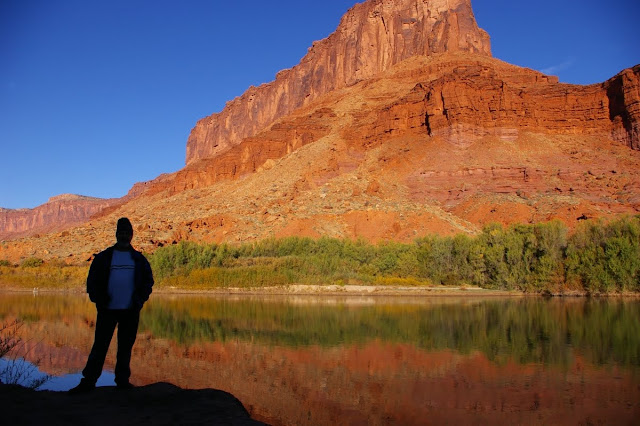
I wanted to see the hills of Golden Canyon from above so I took the east road past Furnace Creek Resort on up to the overlook at Zabriskie Point. From there I could see Manly Beacon and the crinkled badlands below. There I met Debra, another photography addict, who was raised in Pahrump, Nevada and we talked about digital technology for awhile and I had her take my photo at the overlook.
Later that day I took on Mosaic Canyon, a similar but less visited area near Stovepipe Wells whose marble walls have been polished by eons of flash flooding, and where varied bits and pieces of colorful stone conglomerate have formed the “mosaic” designs. Death Valley is nothing if not colorful. True, there is a decided lack of the color green but, otherwise, the ocher, maroon, lavender, vermilion, umber, saffron landscape is in constant flux as light and shadow play across its creases and folds.

For true green, one can spend some time at Furnace Creek which is where I stopped on my way back from Mosaic Canyon. The stores, resort, golf course, gas station and other developments attract hordes of tourists and today was no exception. For awhile, I found a spot beneath some huge date palms where I tried reading more of The Big Sleep but the noise of traffic and humanity was more than I could bear and I returned to my campsite.

I knew that I would be leaving Death Valley the following day and I was determined to get on the road before dawn. My goal was to be at Badwater just at sunrise to get the classic view of the sunlit Panamint Range reflected in the salty pools at the lowest spot in the continental United States. So I retired early into my little car cubicle and made ready for the final leg of my trip home.

Sunday, April 4, 2010

INTO THE MILD -Part Six


March 19 - I bid an early morning farewell to the Econo Lodge and eagerly left Mojave behind, driving north on Highway 14 toward Ridgecrest. This is not the consummate desert drive, by any means but a long, barren stretch of roadway flanked by the Tehachapi Mountains to the west and miles of creosote flatlands to the east. At the nearly deserted crossroads of Olancha, one turns east on highway 190 which follows the south shore of Owens Dry Lake. This is a lake that used to be a vital waterway before being diverted in the early part of the 20th century to support the burgeoning city of Los Angeles. Now it is just a dusty white sheet across the landscape.

As with Zion National Park, this week marked the 43rd anniversary of my first visit to Death Valley which was part of a geology field class out of Foothill College in the spring of 1967. My first ever glimpse of southwestern deserts and the beginning of a lifelong love affair. For some people, Death Valley may be the hardest of all American deserts to love. It is certainly the harshest and most intimidating. That includes the narrow, winding route from the west which climbs over the Argus Range, drops steeply into the Panamint Valley, climbs again over the Panamint Range, then drops even more steeply into Death Valley itself. The temperature at 5,000’ Towne Pass was 53 degrees. By the time I reached Stovepipe Wells, near sea level, it was a warm 75 degrees. Just before I reached Furnace Creek, a lone coyote loped across the road in front of me. It was almost as if he was the official greeter.

The one thing I had not anticipated was just how many other people might have the same idea as I did about getting away to some hot desert country. The campgrounds in the Valley were all pretty crowded, and Furnace Creek was alive with activity. By the time I got to Texas Spring, there were only about six pathetic sites left. So I took the least pathetic of the lot, a 200’ square foot chunk of gravel across from the campground host, the restroom, and a telephone booth. It was a real comedown from my bucolic space at the Carrizo Plain, but I vowed to make the best of it. After all, it was now nearly 85 degrees and I was wearing shorts and a t-shirt for the first time in months.

I spent the remainder of the afternoon driving south to Badwater which was bad for lighting and bad for solitude at the moment. Lots of folks scrambling around on the salt flats. Artists Drive was busy as well, and the trail head parking at Golden Canyon was nearly full. So I repaired to Furnace Creek for a few supplies, then returned to my campsite where I found shade in the shadow of the Subaru and started reading Raymond Chandler’s The Big Sleep. I figured I would pass the time until dusk when I could drive back out to Stovepipe Wells and catch the optimum light on the sand dunes.

It is a nearly 30 mile drive back to Stovepipe Wells from Texas Spring but I timed my arrival pretty well as the shadows were lengthening on the dunes. I avoided the official parking lot where tourists were climbing like ants all over the sand and marring the dune patterns. Instead I went down the road a bit farther, parked on a shoulder, and walked in from a less utilized location. I spent the next forty minutes or so wandering through the mounds and hummocks of sand, photographing ripples, mud cracks, and shadowed slopes. I was not disappointed.

By the fading light of dusk, I headed back to my campsite, mesmerized by the multicolored landscape. I vowed to get up early the next morning and beat the crowds to some of my favorite spots.

Thursday, April 1, 2010

INTO THE MILD - Part Five


March 18 - From my quiet campsite in the heart of the Carrizo Plain, I watched the morning sun rise big and red through the smog and haze of the Central Valley. Once I packed things up and began driving north again, I left much of the bad air behind me. The fields of flowers became more dominant, many of them sparkling with dew. I was constantly stopping the car and getting out for the photo ops. My primary destination for the morning was Soda Lake and the Walker Creek area where an interpretive trail runs right along the San Andreas Fault.

The dirt road to the Walker Creek trailhead was unrelenting in its show of unbroken blooms of fiddlenecks, filaree and daisies. The show just kept getting better and better. The short trail leads to a point on Walker Creek where fault displacement has occurred over time and one can see the stream bed suddenly making a 90 degree turn to the right and then, in another 100 yards or so, making another 90 degree turn to the left; dynamic visual evidence of major movement along the San Andreas.

After six days of heading in a more or less westerly direction, I was finally heading east again. My rather unambitious goal for the day was to reach the desert town of Mojave where I had a motel room reserved. I had plenty of time to take it slow and easy. When I got onto the pavement again on Hwy.58, I left the Carrizo Plain behind me as I began an easy climb up and over the Temblor Range. Here too the flower displays were spectacular, enhanced by bucolic old ranch buildings and occasional groups of cattle. As I got closer to the town of Taft, these eventually gave way to stark, eroded hillsides decked with oil derricks and machinery.

The Carrizo Plain is a sad reminder of what much of the western San Joaquin Valley may have been like several generations ago. In places like Taft, McKittrick, and big daddy Bakersfield the current status of the valley is all too visible. Over-farmed landscapes. Oil rigs. Air pollution. Constant heavy traffic on Hwy. 99 & Interstate 5. And franchise food joints at every interchange. Industrial farming at its worst. I was determined to stay off of the main roads and headed instead for hwy. 223 toward Arvin and the Tehachapi Mountains.

Because of the heavy haze, I couldn’t actually see the Tehachapis until I had passed through Arvin where they began to loom impressively in the near distance. As soon as the highway began its climb into the mountains, I was treated to the site of vast orange splotches of poppies on the flanks of the hills and deep purple lupine in the pastures, the two species intermingling throughout with deep green grasses to create a quintessential California palette of colors. I remembered journal entries I had read from some of the earliest Spanish explorers who described a landscape knee deep in native flowers and vegetation, in the days before invasive grasses and star thistle.


Once I connected again with Highway 58 near Caliente, it was a roller coaster ride up and down in fast lanes of traffic, over the Tehachapi Summit and down the eastern side where the oaks and chaparral gave way to Joshua trees and a man made forest of gigantic windmills. As I pulled into Mojave in the late afternoon, I was met with a furious wind storm and sought shelter at the nearby Econo Lodge where another east Indian fellow graciously showed me to my room. There I took the opportunity to plug in and recharge my cell phone, camera battery and portable dvd player, all the important components of a modern day journey.

The manager told me that the best place in town to eat was Mike’s Cafe. If you’ve been to Mojave, you know this isn’t saying too much. Located on the main drag, the place fairly rattles when heavy trucks drive by. And with hardcore country music blaring from within, I knew I’d found the proper ambience for dinner. Furthermore, on a large shelf that circumnavigated the entire establishment was an incredible collection of vintage pedal car toys, at least fifty of them, probably worth more than the business itself. And there were more of those Mormon humor books about “Alzhimers” and raising kids and being married. It was an abrupt wake up call that I was back in the Mojave Desert again and that Death Valley National Park was a relative hop, skip and a kangaroo rat jump away.