Ruminations From the Western Slope

Ruminations From the Western Slope
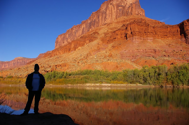
Colorado River near Moab, Utah
Showing posts with label travel. Show all posts

Wednesday, July 20, 2011

Bruneau Dunes: A Hidden Gem in Southern Idaho


I don’t usually write travel pieces per se but in this day and age of crowded campgrounds and over marketed tourist traps, I’d like to mention a prosaic little area I recently had the pleasure of spending a night at. For anyone traveling through the vast open spaces of southern Idaho, Bruneau Sand Dunes State Park is a welcome stopover on the way to or from eastern Oregon. It has impressive sand dunes, lots of wildlife, marshes and small lakes, and it is wonderfully under used by human beings. We first discovered it back in 2005 when we were planning to visit my friend Stan up in Bend, Oregon. The idea was to head north out of Grand Junction, Colorado straight up the western edge through Flaming Gorge and on up into Wyoming. From there we would skirt across the southern half of Idaho, a state I was woefully unfamiliar with.

I had no idea where we could camp as we got near the southwestern corner but I wanted to be somewhere near the Snake River. A little googling of the Idaho State Park system brought up a photo of some large mountains of sand looming over a small marshy lake. Seemed like it might be a hidden gem so I booked a campsite…or rather a camping cabin which is basically a small roofed structure with a bunk bed, table, heater, and electricity. Water is from a nearby pump and cooking can be done at a picnic table or fire ring just beyond the covered porch from which an expansive view of the dunes can be enjoyed. Within the campground itself is a large centrally located restroom complete with hot showers! But there are clean pit toilets along the fringes for the less picky.

When we returned there last month for a one night stay we were greeted by a large gopher snake slithering across the porch. Rain appeared imminent so the covered cabin was a welcome amenity. The rest of the campground was virtually empty. Once settled in, we got out to see the very large dune fields which rise in grayish brown hummocks along one edge of a small valley. It didn’t take long to see numerous birds coming and going from the natural lake at the base of the dunes. In a few minutes time we saw curlews, northern harriers, killdeer and several ducks. A great blue heron rose from the shallows in front of us. My daughter Lindsay climbed to the top of the nearest dune.

Meanwhile we were surrounded by the vast volcanic tablelands and low, heavy skies of the Snake River country. I watched clouds climbing over distant mesas as they darkened and spread our way. But it remained dry long enough for us to prepare a typical camping dinner outside. The rain came later when we were safely ensconced inside the cabin and the sound of the light downpour was particularly soothing.

The following morning dawned clean and clear and we quickly cleaned up our site and were soon on our way. But we will likely return to Bruneau Dunes whenever our travels take us through southern Idaho. For those of you intrigued enough by my rhapsodic waxing, I include a link to the State Park site. Check it out. I don't think you will be disappointed.

http://parksandrecreation.idaho.gov/parks/bruneaudunesstatepark.aspx

Saturday, September 11, 2010

The Cabin in the Crags

I felt a pang of post-Reunion sadness when I left the Crown Plaza at the crack of dawn on Sunday, August 15. It was a bittersweet farewell to the area where I was raised and nurtured. But at the same time, I had a keen sense of excitement knowing that I was heading south to make just one more visit to Pinnacles National Monument, my first Park Service home, . My friend Eric, who was now superintendent of the park, had just accepted a transfer to the Badlands of South Dakota so this would be my last chance to visit with him and his family for awhile, and my last chance to spend a night in Bear Gulch.

Nearly forty years ago I moved into a 12’ x 16‘, one room cabin in the Bear Gulch area of the Pinnacles, a sturdy little structure built toward the end of the 1920s as part of a series of one and two-room tourist cabins, made out of wood with a solid stone facade covering the lower half. It had a stove, sink, cabinets and water heater on one side, and a small bathroom cubicle in the back. I hung a cheap Cost Plus Indian print across the middle to define a bedroom space.

I lived in Cabin #8 as it was called for two years, and it was a wonderful place to hole up after a day’s work. I often had families of raccoons as visitors but seldom any humans. When friends did visit, they slept on what little floor space was available. The winter darkness could be deep and cold. One time I nearly got flooded out when the banks of Bear Creek overflowed. But mostly I loved the unique isolation of the place.

By the time Eric took over several years ago, all the cabins had been converted either to offices or storage space with the exception of Cabin #10, just up the hill from my old place (which is now the Condor Program Office). It seems that Cabin #10 had been tricked out as an overnight pad for visiting researchers or special guests. It is even smaller than Cabin #8....perhaps 10’ x 12’ at the most with the basic amenities and a bunk bed. And Eric gave me the opportunity to stay there one more time.

After dinner with the family at their ranch land home near San Benito, I made the dusky five-mile drive into the park proper. As I reached the wooded confines of Bear Gulch, I was flooded with memories of those early park service days...the steep learning curve, the federal bureaucracy, the anxieties of talking to park visitors. Later there was the quickie first marriage, the ignored induction papers, and plans to head for Canada (but that’s another story). Lots of emotional ups and downs bouncing around Bear Gulch.

But tonight it was quiet, empty and warmly welcoming. I moved into Cabin #10 with minimal gear, unpacked the sleeping bag on the lower bunk, and then spent several minutes just sitting on the stone porch watching the darkness settle into the canyon and looking down at Cabin #8, just a few yards away. What a fantastic twist of fate it was that allowed me to live and work here, and be privy to its magic. And here I was 39 years later, spending one last night.

The following morning I left it all behind and drove out to highway 25 before the sun was up. I headed north toward Hollister, stopping frequently to photograph the first light on valley oaks and golden grasses, to watch a flock of wild turkeys, and admire the migrant workers who were already at work in the fields near Paicines. At a small cafe in Tres Pinos called Flapjacks, I had breakfast and chatted with the owners Phil and Karen who proudly posed for me in front of their place. After that it was back to the road, toward the Sierra Nevada and the first leg of my long trip home.

Wednesday, June 16, 2010

The New Mexico of Memory

When we crossed into New Mexico from Colorado two weeks ago, I swear that the sky suddenly changed, taking on a clarity and depth not found anywhere else. We journeyed over rolling high hills dotted with pines, took in little towns like Tierra Amarilla and Los Ojos, photographed crumbling adobes, and stopped at roadside churches. And all the while there was that deep blue sky overhead. It stayed with us as we descended from Chama into the badlands around Ghost Ranch where we camped for the night in a nearly deserted campground, surrounded by pinyon and juniper and Georgia O’Keefe’s colorful cliffs.

We lived in Albuquerque in the late 90s while I rangered away at Petroglyph National Monument, one of those politically created parks that should have been given to the city to manage instead of the Department of Interior. By the time I got there in 1994, the burgeoning tract homes had already been built right up to the volcanic escarpment on which most of the petroglyphs had been carved. There were literally petroglyphs in peoples’ backyards. The City of Albuquerque hated the park because it was an impediment to further development. Later political machinations by Sen. Domenici allowed a corridor to be removed from the park boundary and made available for a four-lane highway in order to facilitate development on the west mesa.

As a result, these “sacred images” carved in stone now look down upon strip malls, neighborhoods, and gridlocked traffic. There are few places where one can experience the actual context in which these images were made. To add insult to injury, in 1997 a new superintendent took over the reins of the monument and immediately alienated the entire park staff. A woman with a chip on her shoulder and a hatred of white males. Despite our pleas to upper management over the next couple of years, little was done to curb the lying, deception and abuse. I saw the writing on the wall and got out at the end of 1998. Leaving New Mexico was one of the hardest things we ever did.

And that superintendent......She eventually got caught using her government credit card to pay off gambling debts and was removed and demoted (anyone else would have been fired). I went on to bigger and better things with the Bureau of Land Management at Red Rock Canyon in Nevada.

But being back in New Mexico again two weeks ago was still a bit of heaven. We gorged ourselves on cultural and tourist sites in Albuquerque, attended a festival in Santa Fe, and ate lots of green chili. We took the High Road to Taos through little towns like Nambe, Chimayo, Truchas and Las Trampas....towns that have changed little over the years and still reflect the rural Hispanic culture when you look between the art galleries and get off of the beaten path.

So maybe the sky really didn’t change at the Colorado/New Mexico border but my emotions certainly did. We were back in a place we had called home. The place where we honeymooned. The place where our daughter was born. A place that is truly the Land of Enchantment.

Sunday, April 4, 2010

INTO THE MILD -Part Six


March 19 - I bid an early morning farewell to the Econo Lodge and eagerly left Mojave behind, driving north on Highway 14 toward Ridgecrest. This is not the consummate desert drive, by any means but a long, barren stretch of roadway flanked by the Tehachapi Mountains to the west and miles of creosote flatlands to the east. At the nearly deserted crossroads of Olancha, one turns east on highway 190 which follows the south shore of Owens Dry Lake. This is a lake that used to be a vital waterway before being diverted in the early part of the 20th century to support the burgeoning city of Los Angeles. Now it is just a dusty white sheet across the landscape.

As with Zion National Park, this week marked the 43rd anniversary of my first visit to Death Valley which was part of a geology field class out of Foothill College in the spring of 1967. My first ever glimpse of southwestern deserts and the beginning of a lifelong love affair. For some people, Death Valley may be the hardest of all American deserts to love. It is certainly the harshest and most intimidating. That includes the narrow, winding route from the west which climbs over the Argus Range, drops steeply into the Panamint Valley, climbs again over the Panamint Range, then drops even more steeply into Death Valley itself. The temperature at 5,000’ Towne Pass was 53 degrees. By the time I reached Stovepipe Wells, near sea level, it was a warm 75 degrees. Just before I reached Furnace Creek, a lone coyote loped across the road in front of me. It was almost as if he was the official greeter.

The one thing I had not anticipated was just how many other people might have the same idea as I did about getting away to some hot desert country. The campgrounds in the Valley were all pretty crowded, and Furnace Creek was alive with activity. By the time I got to Texas Spring, there were only about six pathetic sites left. So I took the least pathetic of the lot, a 200’ square foot chunk of gravel across from the campground host, the restroom, and a telephone booth. It was a real comedown from my bucolic space at the Carrizo Plain, but I vowed to make the best of it. After all, it was now nearly 85 degrees and I was wearing shorts and a t-shirt for the first time in months.

I spent the remainder of the afternoon driving south to Badwater which was bad for lighting and bad for solitude at the moment. Lots of folks scrambling around on the salt flats. Artists Drive was busy as well, and the trail head parking at Golden Canyon was nearly full. So I repaired to Furnace Creek for a few supplies, then returned to my campsite where I found shade in the shadow of the Subaru and started reading Raymond Chandler’s The Big Sleep. I figured I would pass the time until dusk when I could drive back out to Stovepipe Wells and catch the optimum light on the sand dunes.

It is a nearly 30 mile drive back to Stovepipe Wells from Texas Spring but I timed my arrival pretty well as the shadows were lengthening on the dunes. I avoided the official parking lot where tourists were climbing like ants all over the sand and marring the dune patterns. Instead I went down the road a bit farther, parked on a shoulder, and walked in from a less utilized location. I spent the next forty minutes or so wandering through the mounds and hummocks of sand, photographing ripples, mud cracks, and shadowed slopes. I was not disappointed.

By the fading light of dusk, I headed back to my campsite, mesmerized by the multicolored landscape. I vowed to get up early the next morning and beat the crowds to some of my favorite spots.

Thursday, April 1, 2010

INTO THE MILD - Part Five


March 18 - From my quiet campsite in the heart of the Carrizo Plain, I watched the morning sun rise big and red through the smog and haze of the Central Valley. Once I packed things up and began driving north again, I left much of the bad air behind me. The fields of flowers became more dominant, many of them sparkling with dew. I was constantly stopping the car and getting out for the photo ops. My primary destination for the morning was Soda Lake and the Walker Creek area where an interpretive trail runs right along the San Andreas Fault.

The dirt road to the Walker Creek trailhead was unrelenting in its show of unbroken blooms of fiddlenecks, filaree and daisies. The show just kept getting better and better. The short trail leads to a point on Walker Creek where fault displacement has occurred over time and one can see the stream bed suddenly making a 90 degree turn to the right and then, in another 100 yards or so, making another 90 degree turn to the left; dynamic visual evidence of major movement along the San Andreas.

After six days of heading in a more or less westerly direction, I was finally heading east again. My rather unambitious goal for the day was to reach the desert town of Mojave where I had a motel room reserved. I had plenty of time to take it slow and easy. When I got onto the pavement again on Hwy.58, I left the Carrizo Plain behind me as I began an easy climb up and over the Temblor Range. Here too the flower displays were spectacular, enhanced by bucolic old ranch buildings and occasional groups of cattle. As I got closer to the town of Taft, these eventually gave way to stark, eroded hillsides decked with oil derricks and machinery.

The Carrizo Plain is a sad reminder of what much of the western San Joaquin Valley may have been like several generations ago. In places like Taft, McKittrick, and big daddy Bakersfield the current status of the valley is all too visible. Over-farmed landscapes. Oil rigs. Air pollution. Constant heavy traffic on Hwy. 99 & Interstate 5. And franchise food joints at every interchange. Industrial farming at its worst. I was determined to stay off of the main roads and headed instead for hwy. 223 toward Arvin and the Tehachapi Mountains.

Because of the heavy haze, I couldn’t actually see the Tehachapis until I had passed through Arvin where they began to loom impressively in the near distance. As soon as the highway began its climb into the mountains, I was treated to the site of vast orange splotches of poppies on the flanks of the hills and deep purple lupine in the pastures, the two species intermingling throughout with deep green grasses to create a quintessential California palette of colors. I remembered journal entries I had read from some of the earliest Spanish explorers who described a landscape knee deep in native flowers and vegetation, in the days before invasive grasses and star thistle.


Once I connected again with Highway 58 near Caliente, it was a roller coaster ride up and down in fast lanes of traffic, over the Tehachapi Summit and down the eastern side where the oaks and chaparral gave way to Joshua trees and a man made forest of gigantic windmills. As I pulled into Mojave in the late afternoon, I was met with a furious wind storm and sought shelter at the nearby Econo Lodge where another east Indian fellow graciously showed me to my room. There I took the opportunity to plug in and recharge my cell phone, camera battery and portable dvd player, all the important components of a modern day journey.

The manager told me that the best place in town to eat was Mike’s Cafe. If you’ve been to Mojave, you know this isn’t saying too much. Located on the main drag, the place fairly rattles when heavy trucks drive by. And with hardcore country music blaring from within, I knew I’d found the proper ambience for dinner. Furthermore, on a large shelf that circumnavigated the entire establishment was an incredible collection of vintage pedal car toys, at least fifty of them, probably worth more than the business itself. And there were more of those Mormon humor books about “Alzhimers” and raising kids and being married. It was an abrupt wake up call that I was back in the Mojave Desert again and that Death Valley National Park was a relative hop, skip and a kangaroo rat jump away.