Ruminations From the Western Slope

Ruminations From the Western Slope
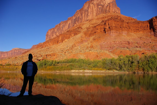
Colorado River near Moab, Utah
Showing posts with label desert. Show all posts

Monday, April 5, 2010

INTO THE MILD - Conclusion


March 21 - I have never regretted being an early riser. There is something almost holy about going out into a world still mostly asleep and catching the first deep lavender makings of dawn on the eastern horizon. There is an optimism about starting a new day. And there is opportunity for us shutterbugs who need to catch that first, golden light.

And so it was with me. I was packed and out of the campground before sun up. As I proceeded south along the eastern edge of Death Valley, I watched that first light hit the top of the Panamint Range, highlighting the snowcapped Telescope Peak (at 11,000’+ the highest point in Death Valley). I had sixteen miles between me and Badwater so I took it slow and easy on the curvy two-lane road. Along the way, I saw my first Death Valley wildflowers, a large array of brown-eyed evening primrose. When I finally pulled into an empty Badwater parking area, I was the only human anywhere in sight. and the lighting was just about as perfect as I could wish for.

There were only two minor logistical problems. Due to resource damage from the hordes of people who now regularly descend upon the salt flats here, the National Park Service built a raised boardwalk several years ago which allows for a decent view of the lowest point in the United States but intrudes itself into the reflecting salt pools. Furthermore, there are several emphatic signs admonishing visitors to not get off of said boardwalk. This makes capturing the classic morning view of the pools well nigh impossible anymore. With a bit more thought, the boardwalk could have been more optimally placed but such is sadly not the case.

Well, I am an early riser. And there clearly was not another human being within several miles. So I gingerly stepped off the boardwalk and trod as lightly as I could to a point where I could capture that fabled reflection of the Panamints in the salt pool. By squatting at just the right spot, I was able to lose the boardwalk off the left hand frame and get a close approximation of the picture I had wanted so badly....not perfect by any means but still pretty impressive. I have to point out that I was not being cavalier about this because I am an ex-ranger and feel somehow privileged to break park rules. But sometimes regulations need to bent just a little bit if one knows that no real damage is being done.

I rattled off several frames before returning to my car and continuing the long, leisurely drive toward Jubilee Pass. Along the way I was treated to more patches of primrose, and great sweeping vistas of salt flats, standing water reflections, fat green creosote bushes, and broad alluvial fans swooping down from the Panamints. I gloried in the quintessence of Mojave desert as I climbed over Jubilee Pass toward Shoshone. I was so energized that I ended up driving all the way to Kanab, Utah that night and all the way home to Grand Junction, Colorado the following day.

Behind me I had put the haunting hoodoos of the Paria Plateau, the snowy stretches of Zion’s east rim, the mysteries of Wash #5 in the Valley of Fire, the almost incomprehensible wildflower displays of the Carrizo Plain, and the craggy crescendo of Death Valley itself. In between were the quirky cafes, cheap hotels, bucolic towns and abandoned homesteads that enhanced the journey. And most of all, I got to feel the warm sun I so desperately missed through the long Colorado winter. And as I write this, the skies are once again clouding up and threatening more rain and snow. God bless the Mojave and the Great American deserts! Long may they remain!


INTO THE MILD -Part Seven


March 20 - The older I get the harder it is for me to sleep on the ground, a sobering admission from an ex-park ranger who used to be able to sleep just about anywhere. But I’ve got the car camping thing down pretty well now. I’ve got a small foam pad, my sleeping bag, and a pillow. And with the back seats folded down, I can sleep comfortably in the back of the Subaru in a diagonal, moderately fetal position. I’ve got my reading light, my books, and a few extra odds and ends. And when I shut the car doors, I also have silence. In the full-to-the-max Texas Spring campground, where every manner of thoughtless camper was staying, this was a good thing. Once inside the car, I could not hear the barking dogs, the motorcycles, or the crying kids. I got out my portable dvd player and watched an old episode of Mystery Science Theater 3000, and I was a happy camper.

Determined to get the jump on said campers and tourists, I lit out the following day at the first light of dawn for the trail head at Golden Canyon. The place really lived up to its name too as the amber light of the first official day of spring seeped down its cream-colored slopes. It was an easy walk up a rocky, shaded wash. The hills above literally glowed in the morning sun. And there were numerous little side canyons to divert my attention as well. When I emerged from the canyon about 90 minutes later, the parking lot was already full....and I had had my fill of Golden Canyon.

I wanted to see the hills of Golden Canyon from above so I took the east road past Furnace Creek Resort on up to the overlook at Zabriskie Point. From there I could see Manly Beacon and the crinkled badlands below. There I met Debra, another photography addict, who was raised in Pahrump, Nevada and we talked about digital technology for awhile and I had her take my photo at the overlook.
Later that day I took on Mosaic Canyon, a similar but less visited area near Stovepipe Wells whose marble walls have been polished by eons of flash flooding, and where varied bits and pieces of colorful stone conglomerate have formed the “mosaic” designs. Death Valley is nothing if not colorful. True, there is a decided lack of the color green but, otherwise, the ocher, maroon, lavender, vermilion, umber, saffron landscape is in constant flux as light and shadow play across its creases and folds.

For true green, one can spend some time at Furnace Creek which is where I stopped on my way back from Mosaic Canyon. The stores, resort, golf course, gas station and other developments attract hordes of tourists and today was no exception. For awhile, I found a spot beneath some huge date palms where I tried reading more of The Big Sleep but the noise of traffic and humanity was more than I could bear and I returned to my campsite.

I knew that I would be leaving Death Valley the following day and I was determined to get on the road before dawn. My goal was to be at Badwater just at sunrise to get the classic view of the sunlit Panamint Range reflected in the salty pools at the lowest spot in the continental United States. So I retired early into my little car cubicle and made ready for the final leg of my trip home.

Sunday, April 4, 2010

INTO THE MILD -Part Six


March 19 - I bid an early morning farewell to the Econo Lodge and eagerly left Mojave behind, driving north on Highway 14 toward Ridgecrest. This is not the consummate desert drive, by any means but a long, barren stretch of roadway flanked by the Tehachapi Mountains to the west and miles of creosote flatlands to the east. At the nearly deserted crossroads of Olancha, one turns east on highway 190 which follows the south shore of Owens Dry Lake. This is a lake that used to be a vital waterway before being diverted in the early part of the 20th century to support the burgeoning city of Los Angeles. Now it is just a dusty white sheet across the landscape.

As with Zion National Park, this week marked the 43rd anniversary of my first visit to Death Valley which was part of a geology field class out of Foothill College in the spring of 1967. My first ever glimpse of southwestern deserts and the beginning of a lifelong love affair. For some people, Death Valley may be the hardest of all American deserts to love. It is certainly the harshest and most intimidating. That includes the narrow, winding route from the west which climbs over the Argus Range, drops steeply into the Panamint Valley, climbs again over the Panamint Range, then drops even more steeply into Death Valley itself. The temperature at 5,000’ Towne Pass was 53 degrees. By the time I reached Stovepipe Wells, near sea level, it was a warm 75 degrees. Just before I reached Furnace Creek, a lone coyote loped across the road in front of me. It was almost as if he was the official greeter.

The one thing I had not anticipated was just how many other people might have the same idea as I did about getting away to some hot desert country. The campgrounds in the Valley were all pretty crowded, and Furnace Creek was alive with activity. By the time I got to Texas Spring, there were only about six pathetic sites left. So I took the least pathetic of the lot, a 200’ square foot chunk of gravel across from the campground host, the restroom, and a telephone booth. It was a real comedown from my bucolic space at the Carrizo Plain, but I vowed to make the best of it. After all, it was now nearly 85 degrees and I was wearing shorts and a t-shirt for the first time in months.

I spent the remainder of the afternoon driving south to Badwater which was bad for lighting and bad for solitude at the moment. Lots of folks scrambling around on the salt flats. Artists Drive was busy as well, and the trail head parking at Golden Canyon was nearly full. So I repaired to Furnace Creek for a few supplies, then returned to my campsite where I found shade in the shadow of the Subaru and started reading Raymond Chandler’s The Big Sleep. I figured I would pass the time until dusk when I could drive back out to Stovepipe Wells and catch the optimum light on the sand dunes.

It is a nearly 30 mile drive back to Stovepipe Wells from Texas Spring but I timed my arrival pretty well as the shadows were lengthening on the dunes. I avoided the official parking lot where tourists were climbing like ants all over the sand and marring the dune patterns. Instead I went down the road a bit farther, parked on a shoulder, and walked in from a less utilized location. I spent the next forty minutes or so wandering through the mounds and hummocks of sand, photographing ripples, mud cracks, and shadowed slopes. I was not disappointed.

By the fading light of dusk, I headed back to my campsite, mesmerized by the multicolored landscape. I vowed to get up early the next morning and beat the crowds to some of my favorite spots.

Thursday, April 1, 2010

INTO THE MILD - Part Five


March 18 - From my quiet campsite in the heart of the Carrizo Plain, I watched the morning sun rise big and red through the smog and haze of the Central Valley. Once I packed things up and began driving north again, I left much of the bad air behind me. The fields of flowers became more dominant, many of them sparkling with dew. I was constantly stopping the car and getting out for the photo ops. My primary destination for the morning was Soda Lake and the Walker Creek area where an interpretive trail runs right along the San Andreas Fault.

The dirt road to the Walker Creek trailhead was unrelenting in its show of unbroken blooms of fiddlenecks, filaree and daisies. The show just kept getting better and better. The short trail leads to a point on Walker Creek where fault displacement has occurred over time and one can see the stream bed suddenly making a 90 degree turn to the right and then, in another 100 yards or so, making another 90 degree turn to the left; dynamic visual evidence of major movement along the San Andreas.

After six days of heading in a more or less westerly direction, I was finally heading east again. My rather unambitious goal for the day was to reach the desert town of Mojave where I had a motel room reserved. I had plenty of time to take it slow and easy. When I got onto the pavement again on Hwy.58, I left the Carrizo Plain behind me as I began an easy climb up and over the Temblor Range. Here too the flower displays were spectacular, enhanced by bucolic old ranch buildings and occasional groups of cattle. As I got closer to the town of Taft, these eventually gave way to stark, eroded hillsides decked with oil derricks and machinery.

The Carrizo Plain is a sad reminder of what much of the western San Joaquin Valley may have been like several generations ago. In places like Taft, McKittrick, and big daddy Bakersfield the current status of the valley is all too visible. Over-farmed landscapes. Oil rigs. Air pollution. Constant heavy traffic on Hwy. 99 & Interstate 5. And franchise food joints at every interchange. Industrial farming at its worst. I was determined to stay off of the main roads and headed instead for hwy. 223 toward Arvin and the Tehachapi Mountains.

Because of the heavy haze, I couldn’t actually see the Tehachapis until I had passed through Arvin where they began to loom impressively in the near distance. As soon as the highway began its climb into the mountains, I was treated to the site of vast orange splotches of poppies on the flanks of the hills and deep purple lupine in the pastures, the two species intermingling throughout with deep green grasses to create a quintessential California palette of colors. I remembered journal entries I had read from some of the earliest Spanish explorers who described a landscape knee deep in native flowers and vegetation, in the days before invasive grasses and star thistle.


Once I connected again with Highway 58 near Caliente, it was a roller coaster ride up and down in fast lanes of traffic, over the Tehachapi Summit and down the eastern side where the oaks and chaparral gave way to Joshua trees and a man made forest of gigantic windmills. As I pulled into Mojave in the late afternoon, I was met with a furious wind storm and sought shelter at the nearby Econo Lodge where another east Indian fellow graciously showed me to my room. There I took the opportunity to plug in and recharge my cell phone, camera battery and portable dvd player, all the important components of a modern day journey.

The manager told me that the best place in town to eat was Mike’s Cafe. If you’ve been to Mojave, you know this isn’t saying too much. Located on the main drag, the place fairly rattles when heavy trucks drive by. And with hardcore country music blaring from within, I knew I’d found the proper ambience for dinner. Furthermore, on a large shelf that circumnavigated the entire establishment was an incredible collection of vintage pedal car toys, at least fifty of them, probably worth more than the business itself. And there were more of those Mormon humor books about “Alzhimers” and raising kids and being married. It was an abrupt wake up call that I was back in the Mojave Desert again and that Death Valley National Park was a relative hop, skip and a kangaroo rat jump away.

Wednesday, March 31, 2010

INTO THE MILD - Part Four

March 17 - Barstow, California is not exactly the garden spot of the west but in the pre-dawn light almost anything looks better than normal. That being said, I decided to catch the sunrise at Casa del Deseirto, the old Fred Harvey establishment that has been restored and still stands alongside the railroad tracks on the seedier side of town. The impressive Mission Revival structure with its many arches and Spanish flourishes is an architectural gem nearly lost amidst the jumbled rail yards and sere hillsides around it. I got some photographs of the first light of day reflecting off the rails and into the fine old building.

After that it was back to the open road, following old Route 66 through places like Lenwood, Helendale and Oro Grande. Halfway to Lancaster I began to get the classic view of Joshua trees against the snow clad San Gabriels. I got lost several times on roads where minimal maintenance is the rule but I eventually reached Lancaster and from there continued east on Hwy.138 in search of the Antelope Hills Poppy Preserve, a chunk of California real estate set aside strictly for the preservation and enjoyment of spectacular blooming hillsides full of native wildflowers. Unfortunately, I arrived about two weeks too early for the peak blooms so had to content myself with a few patches of poppies and fiddlenecks. But at least I was finally seeing some flowers.

I was determined to reach the Carrizo Plain that afternoon so I continued west to Interstate 5 and drove over Wheeler Ridge into the broad (and smoggy) San Joaquin Valley. The pace of traffic seemed positively frenetic so it was a real relief to bail out at Hwy. 166, a straight-as-an-arrow, two-lane country road that seemed to go on endlessly. The smog and haze was so thick that I drove at least 30 miles before I began to discern the low range of mountains that held my destination. This is the aptly named Temblor Range which runs directly adjacent to and is a product of the San Andreas Fault.

The southern entrance into the Carrizo Plain is a lonely road indeed. Broad and treeless, flanked by two low mountain ranges, the aforementioned Temblor and the Caliente Mountains to the west. Here and there were abandoned farm equipment, crumbling sheds and small alkali ponds. I was beginning to doubt my initial urge to visit this place. But as the pavement ended and I continued north on a wide dirt road, the magic began to kick in. The hills became softer, swathed in green. The green soon turned to the yellow of unbroken flower fields. Masses of wooly daisies, goldfields and fiddlenecks. The smog began to dissipate and my senses could begin to grasp the immense emptiness and beauty of this place.

That afternoon I camped in a copse of eucalyptus trees in the BLM’s KCL Campground, a primitive little spot with eight campsites, tables, no water, no fees, and plenty of solitude. The campground is situated at the base of the Calientes with unobstructed views in nearly all directions. Only three other sites were taken. I spent the remainder of the day wandering the nearby fields photographing flowers and listening to the endless cacophony of bird sounds, mostly meadowlarks and redwing black birds. Later that evening I was serenaded by a great horned owl who had a nest nearby.

It is a rare event anymore to find a campground that is truly quiet, where your fellow campers seem to have a real appreciation of their surroundings. No barking dogs or blaring radios. Not even a campground host. Clearly the Carrizo is not a destination spot and hasn’t made the pages of OUTDOOR magazine yet....and probably never will. The place exists on its own terms for one to accept or reject. I was totally charmed by the place, and slept an untroubled sleep that night in the back of my car.

Tuesday, March 30, 2010

INTO THE MILD - Part Three

March 16 - When we lived in Las Vegas in the late 1990s, the Valley of Fire became one of our primary getaway spots. Only an hour’s drive from the city, it allowed us to leave behind the tawdry, manic energy of the city for the peace, comfort and naturalness of the desert. So here I was once again, waking up to a honey-colored dawn flowing over the cliffs and crags with memories of family walks when my daughter Lindsay was still a toddler.

Buzz, the campground host, had told me the night before that I should check out “Wash #5” on the upper road to White Domes. “Be sure to go upstream”, he said. “You’ll be surprised.” I wasn’t sure what he meant by that as I’d been downstream in Wash #5 many times and while it was certainly spectacular, it was not much different from Washes 1 thru 4. But I learned long ago that one should always listen to campground hosts. They almost always know the territory and are willing to share good information.

So I lit out for the upper road just as the sun was rising above the lower cliffs. No one else was even out and about yet so I had the White Domes area all to myself. I spent a good deal of time photographing that first meeting of sunlight and sandstone along the rim. Then I parked at Wash #5 and headed upstream, walking through soft sand and prickly mesquite. When I’d gone about a quarter of a mile, I came to what I think ol’ Buzz was talking about. The wash was suddenly squeezed in by curving canyon walls resulting in a sinuous, shadowy slot. I was hemmed in on both sides by marvelous swirled and banded sandstone resembling pulled taffy and glowing amber with that first morning light. There were places were I had to crawl on hands and knees to get through but the photo ops were well worth it. The place was truly magical.


I spent a good deal of time in that little paradise but knew I’d have to move on if I were going to invade the heart of the Mojave. So I reluctantly left Valley of Fire behind me, taking the scenic North Shore Drive into Las Vegas to avoid the ugly interstate. That still left much of ugly Vegas to traverse but I took a short break at a Trader Joe’s on the west end of town where I bought some feta cheese and french roast, drove a few blocks to look at our old house on Copperleaf Lane, then continued on through the scenic drive of my old work place, Red Rock Canyon (filled with hordes of tourists enjoying the balmy weather). I kept thinking back to my quiet morning in Wash #5.

My original goal for the day had been Afton Canyon, just west of Baker, California. This is one of the few places where the Mojave River surfaces, creating a riparian habitat in what some call “the Grand Canyon of the Mojave”. I endured the long drive on Interstate 15, dodging drivers in a hurry to get back to L.A. after some fast times in glitter town. West of Baker, as advertised, I found the road to Afton Canyon, a typical graded dirt track that wound for several miles to a nearly-deserted campground, an intrusive railroad trestle, and the anemic Mojave River. I was Immediately put off by the stark campsites, pit toilets and lack of shade. Furthermore, the road continuing into “the Grand Canyon of the Mojave” was under about four feet of water at the crossing point. So I got out and wandered a bit along the waterway, took a few pictures, then realized that I be happier in a decent motel room. So I drove another 30 miles to Barstow where the east Indian fellow at the local Travelodge had a room for rent.

While I hadn’t completely decided it yet, I was feeling pretty strongly that I just might forge further west the following day to reach my ultimate goal....the place I had been curious about for the last several years, a lonely piece of California’s great Central Valley known as the Carrizo Plain.

Sunday, March 28, 2010

INTO THE MILD - Part Two


March 12 - With the seventh coldest winter in Grand Junction’s history still holding firm, I wasn’t about to wait for the first day of spring to take off for warmer climes. Besides, the forecasts all said another storm was imminent so I saddled up the ol’ Subaru and headed out on a clear, crisp Friday morning. Driving the interstate was a necessary evil until I reached Hwy. 24 where I could finally get onto an empty, two-lane blacktop, heading nearly due south toward Hanksville and the snow-covered Henry Mountains.

My sense of anticipation was palpable as I turned east through the badlands of Caineville and the cool canyons of Capitol Reef. Beyond that point were a string of small Mormon towns, lost in time and still locked in ice. Torrey, Loa, Bicknell, and the tundra-white summits near Koosharem where Otter Creek was still flowing under the snow.

Keep driving. Through the volcanic rocks of Kingston Valley; through Circleville past the boyhood home of Butch Cassidy; and farther south through Panguitch, Hatch and Junction. Soon I was following the Sevier River through bucolic ranchlands and farms. After 380 miles, I reached my first destination....Kanab, Utah, once known as “the greatest earth on show.” This is the town that hates the federal government and wants to decommission the local Grand Staircase National Monument, but at the same time thrives on tourist dollars from the thousands of visitors coming through to enjoy their federal lands.

March 13 - I spent the morning hours driving to a used bookstore in Orderville where I bought about two dozen, great old pulp paperbacks. Got back to Kanab before the predicted snow storm hit with a vengeance, and hunkered down at my friend Mike’s house. That evening we watched Hitchcock’s Shadow of a Doubt.

March 14 - Sunday was a free day, of sorts, and the welcomed start of Daylight Savings Time. I hadn’t planned any long distance drives and Mike couldn’t hike with his bad knee, so I decided to go it alone with some further exploration of the Paria Plateau. Big puffy clouds filled the sky and all traces of yesterday’s frantic snowfall were gone. And the Paria welcomed me as it always does with swirly red sandstone and wildly psychedelic erosion. I spent several hours roaming through small slot canyons and amongst giant toadstool shaped rocks. It was a landscape of memory and mystery. And the photo ops were amazing. This area is really the quintessence of the Colorado Plateau region. Later that evening, Mike and I treated ourselves to a viewing of Bad Day at Black Rock with Spencer Tracy and consummate baddies Lee Marvin, Ernest Borgnine and Robert Ryan. It doesn’t get any better than that!

March 15 - For me the real journey started on Monday morning when I said goodbye to Kanab and headed out for the lower deserts. I stopped for breakfast at the Thunderbird Cafe in Mt. Carmel Junction, an institution ‘round these parts. I’m pretty sure that my waitress that morning was a gentile as she was soft spoken, brunette and sincere, unlike the saccharine, disingenuous, blonde honey who effusively greeted me when I entered. On my table were the usual Mormon “humor“ books one finds in southern Utah such as “Old Timers & Alzhimers” (sic), a collection of vastly unfunny vignettes on the hilarity of dementia. Nevertheless, the meal was good and the day was clear.


The east rim of Zion National Park was still covered in snow but it gradually disappeared as I dropped into the canyon, almost 42 years to the day since the first time I visited here (see my blog Get Off the Pot for details). In spite of all the tourists, this place never fails to enchant me. I can almost always ignore the crowds and just look beyond....or walk beyond. But I was on a mission to get warm so I didn’t linger long. I forged my way through the hideous urban mess of Hurricane and St. George, two communities that have utterly lost any charm they may have had twenty years ago to the onslaught of rampant and unchecked growth.

On the Interstate once again, I dropped down through the spectacular Virgin River Gorge into Littlefield, Arizona and 70 degree temperatures, the warmest weather I had experienced in nearly four months. I was focused on reaching the Valley of Fire State Park near Overton, Nevada so it was pretty easy to ignore the gambling come-ons of Mesquite and the beat-up, monoculture of creosote bush in the surrounding landscape. But this was it. I was finally on the edges of the Mojave Desert as I drove into the campground at Valley of Fire, I was looking forward to the days ahead in this hard-edged terrain.

(For the sake of brevity (and because I am falling so far behind), the next installment will be posted soon).

Tuesday, March 9, 2010

INTO THE MILD, PART 1


Last fall when I decided to develop a coping strategy to get me through the winter doldrums, I had no idea that I would be subjected to the seventh coldest winter in the history of the western slope. It began with a record-breaking snowfall on December 7 (a day that will live in weather infamy), followed by a brutal cold snap for ten more weeks and a stubborn inversion layer that stayed firmly ensconced in the Grand Valley.

What was my coping strategy, you might ask? In a nutshell, it was trip planning. I was determined to break away from winter’s grip in the early spring and head for the deserts of southern California. That involved a bit of research, lots of reading, and best of all, a chance to look longingly at lots of sunny photographs of dry, open terrain. I pored over all those evocative names like the Calico Mountains, Kelso Dunes, the Antelope Valley. And I charted out a course that would take me to places such as Valley of Fire, Afton Canyon, Saddleback Butte, the Carrizo Plain and, last but not least, Death Valley.

The colder it got outside, the more I perused my map collection inside. I read The California Deserts by Bruce M. Pavlik all the way through, and I looked back at my collection of desert slides and photographs. And, I must say, it did help a bit though I could never have anticipated how deeply this winter would hang in there.

Another important aspect of the journey for me is the fact that I am traveling solo. A chance to catch up on quiet time, be more reflective, and to concentrate on my art.....my photography. As I get older, it seems more important to be able to still be independent, camping out with just the basics, keeping a loose agenda, and seeing just where my comfort zone has moved to over the years. So I hope to challenge myself just a bit.

So here I am on the brink of departure. Yesterday it snowed here. Rain is expected through Thursday. I hit the road on Saturday. Through it all, I hope to write about the enlightening moments, and to photograph the sublime scenery of the southern deserts. So stay tuned.