Ruminations From the Western Slope

Ruminations From the Western Slope
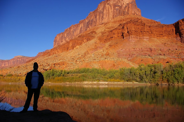
Colorado River near Moab, Utah
Showing posts with label personal journey. Show all posts

Monday, April 5, 2010

INTO THE MILD - Conclusion


March 21 - I have never regretted being an early riser. There is something almost holy about going out into a world still mostly asleep and catching the first deep lavender makings of dawn on the eastern horizon. There is an optimism about starting a new day. And there is opportunity for us shutterbugs who need to catch that first, golden light.

And so it was with me. I was packed and out of the campground before sun up. As I proceeded south along the eastern edge of Death Valley, I watched that first light hit the top of the Panamint Range, highlighting the snowcapped Telescope Peak (at 11,000’+ the highest point in Death Valley). I had sixteen miles between me and Badwater so I took it slow and easy on the curvy two-lane road. Along the way, I saw my first Death Valley wildflowers, a large array of brown-eyed evening primrose. When I finally pulled into an empty Badwater parking area, I was the only human anywhere in sight. and the lighting was just about as perfect as I could wish for.

There were only two minor logistical problems. Due to resource damage from the hordes of people who now regularly descend upon the salt flats here, the National Park Service built a raised boardwalk several years ago which allows for a decent view of the lowest point in the United States but intrudes itself into the reflecting salt pools. Furthermore, there are several emphatic signs admonishing visitors to not get off of said boardwalk. This makes capturing the classic morning view of the pools well nigh impossible anymore. With a bit more thought, the boardwalk could have been more optimally placed but such is sadly not the case.

Well, I am an early riser. And there clearly was not another human being within several miles. So I gingerly stepped off the boardwalk and trod as lightly as I could to a point where I could capture that fabled reflection of the Panamints in the salt pool. By squatting at just the right spot, I was able to lose the boardwalk off the left hand frame and get a close approximation of the picture I had wanted so badly....not perfect by any means but still pretty impressive. I have to point out that I was not being cavalier about this because I am an ex-ranger and feel somehow privileged to break park rules. But sometimes regulations need to bent just a little bit if one knows that no real damage is being done.

I rattled off several frames before returning to my car and continuing the long, leisurely drive toward Jubilee Pass. Along the way I was treated to more patches of primrose, and great sweeping vistas of salt flats, standing water reflections, fat green creosote bushes, and broad alluvial fans swooping down from the Panamints. I gloried in the quintessence of Mojave desert as I climbed over Jubilee Pass toward Shoshone. I was so energized that I ended up driving all the way to Kanab, Utah that night and all the way home to Grand Junction, Colorado the following day.

Behind me I had put the haunting hoodoos of the Paria Plateau, the snowy stretches of Zion’s east rim, the mysteries of Wash #5 in the Valley of Fire, the almost incomprehensible wildflower displays of the Carrizo Plain, and the craggy crescendo of Death Valley itself. In between were the quirky cafes, cheap hotels, bucolic towns and abandoned homesteads that enhanced the journey. And most of all, I got to feel the warm sun I so desperately missed through the long Colorado winter. And as I write this, the skies are once again clouding up and threatening more rain and snow. God bless the Mojave and the Great American deserts! Long may they remain!


Thursday, April 1, 2010

INTO THE MILD - Part Five


March 18 - From my quiet campsite in the heart of the Carrizo Plain, I watched the morning sun rise big and red through the smog and haze of the Central Valley. Once I packed things up and began driving north again, I left much of the bad air behind me. The fields of flowers became more dominant, many of them sparkling with dew. I was constantly stopping the car and getting out for the photo ops. My primary destination for the morning was Soda Lake and the Walker Creek area where an interpretive trail runs right along the San Andreas Fault.

The dirt road to the Walker Creek trailhead was unrelenting in its show of unbroken blooms of fiddlenecks, filaree and daisies. The show just kept getting better and better. The short trail leads to a point on Walker Creek where fault displacement has occurred over time and one can see the stream bed suddenly making a 90 degree turn to the right and then, in another 100 yards or so, making another 90 degree turn to the left; dynamic visual evidence of major movement along the San Andreas.

After six days of heading in a more or less westerly direction, I was finally heading east again. My rather unambitious goal for the day was to reach the desert town of Mojave where I had a motel room reserved. I had plenty of time to take it slow and easy. When I got onto the pavement again on Hwy.58, I left the Carrizo Plain behind me as I began an easy climb up and over the Temblor Range. Here too the flower displays were spectacular, enhanced by bucolic old ranch buildings and occasional groups of cattle. As I got closer to the town of Taft, these eventually gave way to stark, eroded hillsides decked with oil derricks and machinery.

The Carrizo Plain is a sad reminder of what much of the western San Joaquin Valley may have been like several generations ago. In places like Taft, McKittrick, and big daddy Bakersfield the current status of the valley is all too visible. Over-farmed landscapes. Oil rigs. Air pollution. Constant heavy traffic on Hwy. 99 & Interstate 5. And franchise food joints at every interchange. Industrial farming at its worst. I was determined to stay off of the main roads and headed instead for hwy. 223 toward Arvin and the Tehachapi Mountains.

Because of the heavy haze, I couldn’t actually see the Tehachapis until I had passed through Arvin where they began to loom impressively in the near distance. As soon as the highway began its climb into the mountains, I was treated to the site of vast orange splotches of poppies on the flanks of the hills and deep purple lupine in the pastures, the two species intermingling throughout with deep green grasses to create a quintessential California palette of colors. I remembered journal entries I had read from some of the earliest Spanish explorers who described a landscape knee deep in native flowers and vegetation, in the days before invasive grasses and star thistle.


Once I connected again with Highway 58 near Caliente, it was a roller coaster ride up and down in fast lanes of traffic, over the Tehachapi Summit and down the eastern side where the oaks and chaparral gave way to Joshua trees and a man made forest of gigantic windmills. As I pulled into Mojave in the late afternoon, I was met with a furious wind storm and sought shelter at the nearby Econo Lodge where another east Indian fellow graciously showed me to my room. There I took the opportunity to plug in and recharge my cell phone, camera battery and portable dvd player, all the important components of a modern day journey.

The manager told me that the best place in town to eat was Mike’s Cafe. If you’ve been to Mojave, you know this isn’t saying too much. Located on the main drag, the place fairly rattles when heavy trucks drive by. And with hardcore country music blaring from within, I knew I’d found the proper ambience for dinner. Furthermore, on a large shelf that circumnavigated the entire establishment was an incredible collection of vintage pedal car toys, at least fifty of them, probably worth more than the business itself. And there were more of those Mormon humor books about “Alzhimers” and raising kids and being married. It was an abrupt wake up call that I was back in the Mojave Desert again and that Death Valley National Park was a relative hop, skip and a kangaroo rat jump away.

Tuesday, March 9, 2010

INTO THE MILD, PART 1


Last fall when I decided to develop a coping strategy to get me through the winter doldrums, I had no idea that I would be subjected to the seventh coldest winter in the history of the western slope. It began with a record-breaking snowfall on December 7 (a day that will live in weather infamy), followed by a brutal cold snap for ten more weeks and a stubborn inversion layer that stayed firmly ensconced in the Grand Valley.

What was my coping strategy, you might ask? In a nutshell, it was trip planning. I was determined to break away from winter’s grip in the early spring and head for the deserts of southern California. That involved a bit of research, lots of reading, and best of all, a chance to look longingly at lots of sunny photographs of dry, open terrain. I pored over all those evocative names like the Calico Mountains, Kelso Dunes, the Antelope Valley. And I charted out a course that would take me to places such as Valley of Fire, Afton Canyon, Saddleback Butte, the Carrizo Plain and, last but not least, Death Valley.

The colder it got outside, the more I perused my map collection inside. I read The California Deserts by Bruce M. Pavlik all the way through, and I looked back at my collection of desert slides and photographs. And, I must say, it did help a bit though I could never have anticipated how deeply this winter would hang in there.

Another important aspect of the journey for me is the fact that I am traveling solo. A chance to catch up on quiet time, be more reflective, and to concentrate on my art.....my photography. As I get older, it seems more important to be able to still be independent, camping out with just the basics, keeping a loose agenda, and seeing just where my comfort zone has moved to over the years. So I hope to challenge myself just a bit.

So here I am on the brink of departure. Yesterday it snowed here. Rain is expected through Thursday. I hit the road on Saturday. Through it all, I hope to write about the enlightening moments, and to photograph the sublime scenery of the southern deserts. So stay tuned.

Thursday, February 18, 2010

Taking Pescadero

By mid-November of 1963, the theme for the next big Los Altos High School dance had been established. The theme was going to have something to do with the sea; boats, underwater critters, fishing nets, etc. As lowly sophomores who probably wouldn’t get dates for the dance anyway, my friends and I took it upon ourselves to help provide decorations and some kind of coastal ambience. The plan was to drive over to the coast and steal a city limits sign from one of the quiet hamlets south of Half Moon Bay. The sign would end up in the high school gym as appropriate decor for the dance and we would be regaled for our resourcefulness.

On November 21, two days before the dance, we put our plan into motion. Four of us squeezed into Stan’s little Volkswagen bug and, late in the afternoon we headed over the winding, narrow road west of Crystal Springs Reservoir, up and over Skyline Boulevard, and down the curvy backside of the coast range past flower farms and nurseries to Half Moon Bay. From there it was a relatively straight shot south on Highway 1 to the town of Pescadero.

Pescadero had a special meaning for us because we liked to spend time poking around its rocky coastline and enjoying the maritime atmosphere. And, of course, the name was colorful and very coastal Californian. In any case, we reached the outskirts of Pescadero near sunset where we found the simple, green and white metal sign bearing the town’s name. Back in those days, it was fairly easy to make off with street signs like this one, attached to a pole as it were with only two bolts. With a handy wrench we made quick work of the hardware and, while one of us stood guard to make sure no traffic was in sight, the sign was removed and furtively thrown into the back seat of the bug.

You can probably guess the rest of this little story. The following day was November 22, 1963. I was at home that morning faking a head cold and watching television when the defining event of my generation occurred....the assassination of JFK. Needless to say, the big dance was cancelled. The Pescadero sign stood unused in my parents’ garage thereafter.

In subsequent years that sign moved with me and was often displayed in various parts of the American West....in the canyon country of Utah, at Point Reyes National Seashore, in backyards in Phoenix, Redding and Albuquerque, and many other locations my transient existence took me. And I still have it.

Last summer when I chanced to drive through Pescadero once again, I found it was as sleepy and bucolic as it had been back in the 1960s. The new city limits sign was much smaller and much more securely fastened to its post. And I found myself thinking that some day I would like to return to Pescadero, approach the city fathers (if there are any) with my story, seek forgiveness, and return the sign. It has been a part of my life now for nearly 50 years, so maybe it is time to take it back home.

Saturday, February 6, 2010

A River Reminiscence


If there really is a heaven somewhere I hope it looks and feels like Ruby Canyon did that late October day back in 2003. There were three of us on a raft drifting in a dreamlike state through still water; through a corridor of gold and gray and red; sharing the stream with herons, ducks and eagles; and reveling in the heat of a record-breaking late October afternoon. This might have been my best day ever on the river, my moment of spiritual and emotional glory, and the summation of all the personal energy, time, romance and feeling that I have brought into this country and which this country has returned to me a hundred-fold.

We cast off from Loma launch around 9:30am, a bit late by river standards but early enough that much of Horsethief Canyon was still in shadows and as the sun crept into the cottonwood galleries, they would ignite with an almost holy luminescence like torches lighting the way through this watery corridor. Ahead of us, the upper cliffs and buttes were bright with morning light while the canyon mouths waited in cool darkness. A few miles downstream we stopped at the mouth of Rattlesnake Canyon where we exited the raft, and followed the primitive trail up-canyon in search of slickrock. Every turn in the trail brought some new delight. A fresh view. A blazing red squawbush. An eroded alcove. Giant monolithic structures. We soon reached a stony corridor which was still in the shade, a beautifully sculpted section of creek where the gravel and soil had long since been removed, leaving a slickrock staircase through narrow walls. We hung out there for quite a while before returning to the raft.

By then it was nearly noon and we had barely begun the trip. So we pressed on downstream, skirting riffles and eddies, amazed and humbled by the steadily rising cliffs. I sat at the front of the raft, taking it all in, trying to somehow imprint the landscape on my brain, knowing that this could be the last trip I take on the river for quite some time. A float trip always has its own time schedule. The current dictates where you go and how fast you get there. No point in worrying about a time schedule. The scenery slides by at a slow pace massaging the senses as it does. Your eyes fix on a point downstream and that point approaches at an even, minimal pace allowing you to study it, anticipate it, dissect it if need be. The immediate banks of the river move by like the old multi-plane animations of Walt Disney. A cottonwood looms ahead. The view of it then replaced by rising tamarisk. Then a butte rises up from nowhere. And then, in a single instant butte, cottonwood, and tamarisk are all framed exquisitely to the human eye. This is the recurring cycle of floating downstream.

We took a late lunch on the Mee Canyon Bench which was rife with autumn-heavy trees offering shade while framing the surrounding cliffs with great, arching branches and sweeping canopies. We marveled at the absence of any other people. No other floaters. No trains coming through. No hikers. Not even any airplane noise. I fell into deep reminiscence as I sat beneath a mother cottonwood eating my lunch. I thought about Octobers past. I mentally walked myself though all the trails walked, and mesas climbed, and arroyos explored in my thirty-odd years out here. How much sand had accumulated in my shoes? How much red dust in my teeth? How many friends had I taken with me? I felt like I knew so much yet still knew so little about this place, but I felt a peace and comfort verging on nirvana. I felt my life coming full circle in canyon country.

It was after two by the time we got back on the river and now the sun had drifted substantially to the west, sending long shadows across the rocks. As we navigated the whirlpools and rough water of Black Rocks, the Precambrian, polished stone captured and reflected the afternoon light. The rocks loomed out of the water like thick, black icebergs as we moved through the narrow, foam-flecked channel. As we headed west into the sunlight itself, I basked in the heat and the deep blue sky above. In a few more miles, we would transition from the inner depths of Ruby Canyon to the more open shorelines near the Utah/Colorado border.

As soon as one reaches the state line, the river breaks free of the canyon's constraints and enters a broad, brilliant country of free standing buttes, open fields, and thickening cottonwood galleries. With the sun now behind them, the trees were afire with yellow and orange. Along the banks, the squawbush glowed red, while the thick tamarisk stands were haloed in a coppery glow. The overall feeling was one of leaving a great cathedral and ascending to the very portals of a heavenly landscape. Not a single mile was lost on my senses. I drank it in. I stored it. I reveled in it. And I silently congratulated myself for knowing when to take this trip. For having the experience and foresight to time it so perfectly. And I thanked the canyon gods for cooperating with great weather, great colors and great companionship. That day on the river was a distillation of all the Octobers ever spent on the Colorado Plateau, a concentrated dose of all the best this land can offer. I never tire of it. I never fail to be renewed by it. I have a canyon lands dependency.

Wednesday, January 27, 2010

Bridging the Years

My first encounter with the Dewey Bridge was just before Christmas of 1974. As a young park ranger, I had moved to the Needles District of Canyonlands just two months earlier. Awed and slightly intimidated by the remoteness, I quickly adapted to the 160 mile round-trip drive to and from Moab, Utah to buy groceries, pickup mail, make phone calls, and mingle with humanity a bit. At that time, the Atlas Uranium Mill was in the process of shutting down and Moab was a depressed area. People were actually moving away and the population hovered around 4,000.

Services were limited. No liquor, of course (this was still a Mormon town). No book stores, clothing stores, record stores. There was a small Sears Catalog store across the street from the post office where I once ordered a Super 8 film projector so that I could show old movies back in the District. Most everyone I knew said that to do any real shopping, I’d have to go to Grand Junction, Colorado, another 100 miles up the road.

And the best way to do that was to take Utah Highway 128, the River Road. When I discovered the River Road, I discovered a road into my soul. Back then it was a narrow, partially paved ledge that meandered along the banks of the Colorado River, flanked by high red walls of Wingate sandstone, breaking out occasionally into small valleys like the Professor Valley where Fisher Towers, Castle Rock and other stone monoliths stood guard along the edges.

Much of the road was still unpaved including the stream crossings at Onion Creek and Professor Creek where one simply splashed on through. And then, of course, about 28 miles east of Moab, there was the Dewey Bridge, a solid little wooden structure at a sharp bend in the road where a sign warned it was a one-way crossing. It was a narrow bridge even for my little 1973 Datsun pickup. But what an adventure for a boy from the bay area.

For four years I bonded with the River Road and always had a special sense of anticipation at crossing the Dewey Bridge. In 1985 a modern concrete bridge was constructed but the historic Dewey Bridge remained as a footbridge and a palpable reminder of a not-so-distant frontier past. When I returned to the area in 2001, I quickly re-established my relationship with the River Road and the old bridge.

In the spring of 2008, a young boy playing with matches downstream ignited the dry tamarisk along the river bank and the fire rapidly spread upstream where it took out the old bridge, leaving nothing but dangling cables and supports. There is talk of rebuilding it someday but it won’t be the same. Losing the bridge was like losing an old friend.